July 3, 2025
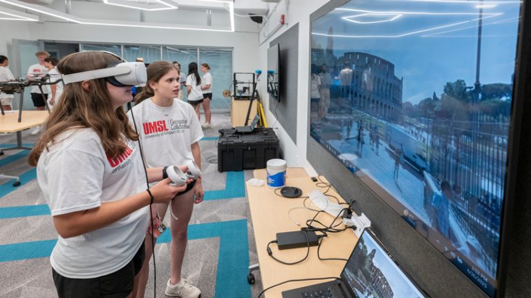
Caleb Craig took the controls of Titan, an agile mobile robot dog, and confidently maneuvered the advanced robot through the fourth-floor hallway of Benton Hall at the University of Missouri–St. Louis. Titan moved forward, backward and even up a set of stairs; raised itself on its haunches; and skirted onlookers in the hallway, all with the flick of a thumb. Craig looked like a seasoned professional controlling Titan Thursday afternoon, but it was the high schooler’s first time interacting with the cutting-edge technology. Meanwhile, Lucie Wildman and Shreya Sadhale had their feet planted solidly in the Geospatial Advanced Technology Lab, yet they were simultaneously worlds away. The two used Google Map Tiles – high-resolution, immersive 3D maps – and virtual reality headsets to explore cities across the globe and renowned landmarks such as San Francisco’s Golden Gate Bridge.
Craig, Sadhale and Wildman were three of the 22 students from more than 20 high schools who attended UMSL’s third annual Geospatial Science Summer Camp. The camp, organized by UMSL’s Geospatial Collaborative, aimed to expose students to Geographic Information System tools and included speakers from NGA and Esri, as well as instruction in tools like ArcGIS and multispectral imagery. “I think the objective is exposure, getting them excited about the field, getting them excited about geospatial,” said Gizelle Cota. Reda Amer added, “We’ve positioned UMSL as a leader of geospatial talent…” Students solved routing challenges, explored the International Space Station in VR, and discovered potential future careers. “You might find out that you really like it, and it’s going to be really relevant in the future,” said Wildman.